
Maple Grove’s water damage profile is shaped by two facts that aren’t obvious until you look at the city’s development history: it grew extremely fast in the 1990s and 2000s, and it did so in a landscape that contains 13 named lakes and an extensive network of stormwater ponds. The result is a city where a significant share of the housing stock was built adjacent to or overlooking water features, using construction practices from an era whose moisture management consequences are now showing up in basements and walls throughout the city.
13 Lakes and Thousands of Pond-Adjacent Lots: The Maple Grove Water Dynamic
Maple Grove’s 13 named lakes — Eagle, Fish, Rice, Cedar Island, Weaver, Pike, and others — are distributed throughout the city alongside an extensive network of stormwater retention ponds. These ponds were built to manage runoff from the development that replaced open fields and wetlands during Maple Grove’s growth years. They work as designed under normal conditions. During heavy rain events, they fill to capacity.
Cedar Island Lake’s history illustrates the dynamics at play. Before 1969, the lake had no natural outlet. As impervious surface increased in the watershed — particularly with the construction of I-494 and I-694 — water loaded into the lake faster than it could evaporate. The lake rose and threatened nearby properties. The solution required DNR-permitted engineered pumping. The underlying cause — too much impervious surface sending runoff into a closed basin — is the same dynamic playing out across Maple Grove’s newer pond network whenever the city receives sustained heavy rainfall.
For properties adjacent to Maple Grove’s ponds and lakes, the relevant water damage mechanism is usually not surface overflow — the ponds are managed against that. It’s groundwater. When a pond fills, the water table at the pond edge rises with it. Basement walls and floor assemblies in pond-adjacent homes experience elevated moisture pressure during and after major storm events, even if the pond itself never overflows.
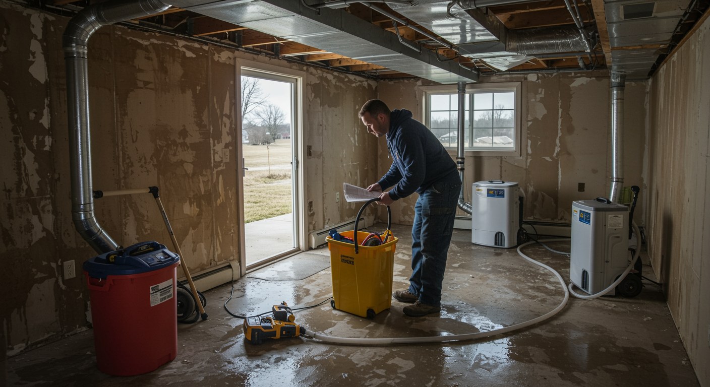
Maple Grove’s 1990s Housing: Three Failure Modes Coming Due
Sump Pump Age
The dominant housing wave in Maple Grove was the 1990s — developments like Arbor Lakes, Elm Creek, Summerfield, and dozens of others that built out the city’s suburban grid. Homes from this era have been through one or two sump pump replacement cycles. The pumps currently in service are 10 to 15 years old in many cases, and a significant portion haven’t been replaced proactively. In pond-adjacent and low-lying Maple Grove lots, sump pump failure during a storm event is the single highest-risk water damage scenario — a failing pump in a finished walkout basement can produce tens of thousands of dollars in damage in hours.
Interior-Insulated Basement Walls
1990s construction built basement walls the same way the 1980s did — interior insulation against concrete foundation walls, often without a drainage plane. This assembly traps moisture from vapor transmission through the concrete. In pond-adjacent Maple Grove homes where soil moisture is persistently elevated, this trapped moisture has been accumulating in wall cavities for 25 to 35 years. Homeowners who are renovating these basements are finding wall cavities with significant mold that pre-existed any specific water event.
Irrigation System Failures
Maple Grove’s landscaped suburban lots are almost universally irrigated, and irrigation supply lines run through foundation walls or under slabs to reach exterior zones. A slow leak in an irrigation supply line inside the wall — from a failed fitting, a freeze-thaw crack in the line, or a valve that doesn’t fully close — can run for months before it becomes detectable. By the time the moisture reaches a visible surface, the wall cavity, insulation, and framing have been saturated long enough to produce mold that extends well beyond the visible damage.
Shingle Creek and Elm Creek Watersheds
Most of Maple Grove drains into two watershed systems. The Shingle Creek Watershed covers the southern and eastern portions of the city, flowing toward Brooklyn Park and the Mississippi River. The Elm Creek Watershed covers the northern portions, draining toward Champlin and the Crow River. Properties near Elm Creek’s tributary channels in northern Maple Grove have flood exposure that extends upstream into Corcoran and Dayton — heavy rainfall in those communities can raise Elm Creek levels in Maple Grove hours later. The Elm Creek Watershed Management Commission and Shingle Creek Watershed have both invested in Maple Grove water quality and flood control projects, and Eagle Lake specifically has received alum treatment through a partnership between the city and the Shingle Creek Watershed.
Frequently Asked Questions — Water Damage Restoration in Maple Grove, MN
Why does Maple Grove have so many pond-adjacent homes with water damage risk?
Maple Grove’s rapid development in the 1990s and 2000s created thousands of lots adjacent to or overlooking stormwater ponds and the city’s 13 named lakes. These ponds and lakes serve as stormwater retention features, which means they fill during heavy rain events. Properties at the pond edge experience groundwater fluctuations tied to pond levels — when the pond is full, the water table at the property boundary rises, increasing moisture pressure against basement foundations and through lower-level floor assemblies.
What happened with Cedar Island Lake flooding in Maple Grove?
Before 1969, Cedar Island Lake had no natural outlet. As development and highway construction increased impervious surface in the drainage area — including the construction of I-494 and I-694 — water began flowing into the lake faster than evaporation could remove it, and the lake rose to levels that threatened nearby properties. The Minnesota DNR ultimately permitted an engineered pumping solution to manage lake levels. This history illustrates a core dynamic in Maple Grove: development increased the water load on the city’s lakes and ponds, and some of those systems are still managed against that increased load.
What water damage issues are most common in Maple Grove’s 1990s homes?
Maple Grove’s dominant housing cohort is 1990s construction — now 25 to 35 years old. Sump pump systems from this era are on their second or third pump, and the aging units that haven’t been proactively replaced are a primary failure risk. Interior-insulated basement walls without drainage planes are accumulating moisture in wall cavities. PVC and early PEX plumbing in some homes is showing the first signs of fitting failures. And irrigation system supply line failures — common in Maple Grove’s landscaped suburban lots — are a leading cause of undetected slow water damage.
Does Shingle Creek or Elm Creek watershed affect Maple Grove flood risk?
Most of Maple Grove drains to Shingle Creek and Elm Creek watersheds. Shingle Creek flows south through Brooklyn Park and Brooklyn Center to the Mississippi River; Elm Creek flows northeast through Champlin and Dayton toward the Crow River. Properties near Elm Creek or its tributary channels in northern Maple Grove have flood exposure tied to the broader watershed — heavy rain in Corcoran or Dayton can raise Elm Creek levels in Maple Grove. Eagle Lake’s Eagle Lake Preservation Association and the Shingle Creek Watershed have both invested significantly in Maple Grove water quality improvements in recent years.
How quickly can Partners Restoration respond to water damage in Maple Grove?
Partners Restoration is based in Medina, approximately 10 to 15 minutes from most Maple Grove neighborhoods via 494. We answer 24/7 at 952.500.2426.
Water damage in Maple Grove? Contact Partners Restoration. Based in Medina, approximately 15 minutes from Maple Grove via 494. Call 952.500.2426 24/7.
Also see: Water damage restoration services in Maple Grove | All restoration and remodeling services in Maple Grove, MN | Insurance claims help
Leave A Comment